

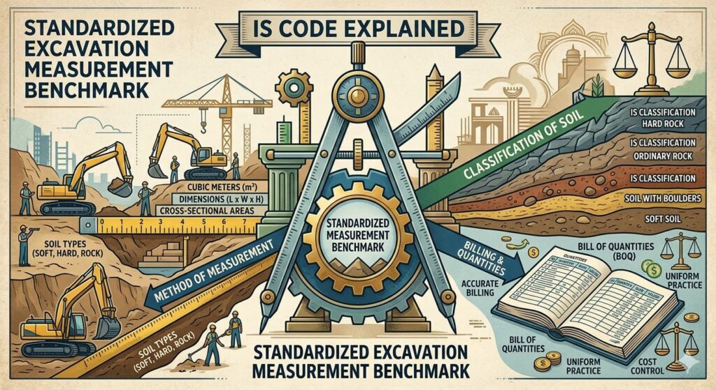
In civil engineering, precision in measurement is essential for accurate billing, auditing, and project control. The IS 1200 (Part 1) 1992 standard defines how earthwork should be measured, ensuring uniformity and reliability across all construction projects.
Excavation Measurement
Measurement in Decimals
According to Clause 2.3, all must be recorded with fine precision:
- Dimensions: Nearest to 0.01 m
- Area: Nearest to 0.01 sq.m
- Volume: Nearest to 0.01 cum
This level of detail helps maintain consistency and minimizes discrepancies in project documentation.
Mode of Measurement
As per Clause 4.1, earthwork quantities are measured in cubic meters (cum) for:
- Excavation
- Backfilling
- Carting away excavated material
Each activity is quantified separately to ensure transparency and accuracy in cost estimation.
Critical Check Points
- Authorized working space: If not specified, a standard 600 mm (from the substructure at the lowest level) is considered.
- Clause 4.2.5 states that quantities should be calculated based on the actual working space or the specified limits — whichever is less.
Special Conditions in Earthwork Measurement
Certain types of work require additional consideration under IS 1200 (Part 1). These include:
- Work involving formwork
- Areas covered externally with damp‑proof coatings
- Surfaces protected with masonry work (brick, stone, precast concrete, etc.)
- Post‑tensioned concrete ground beams, where an extra length of 1.5 m at each end is added
- Specialized works like geniting
- Situations where workmen operate from outside the structure
These provisions ensure that measurements reflect the actual working conditions and space requirements on site.
Surface Excavation
When excavation width exceeds 1.5 m and the plan area is 10 sq.m or more, but the depth is less than 300 mm, it is classified as surface excavation.
Such work is measured in square meters (sqm) rather than cubic meters, since the depth is shallow.
Excavation Over Area
For excavation width greater than 1.5 m and plan area 10 sq.m or more, with depth equal to or greater than 300 mm, the work is described as excavation over areas and measured in cubic meters (cum).
If the excavation depth exceeds 1 m, an allowance of 50 mm per meter depth for each side of the trench is added to the specified width.
This adjustment accounts for the extra working space required for safe and efficient excavation.
Classification of Excavation Materials – Method of Measurement
Accurate classification of soil and rock types is essential for determining excavation methods, equipment selection, and cost estimation. The IS 1200 (Part 1) standard provides clear guidelines for identifying and measuring different materials encountered during earthwork.
Material Characteristics and Verification
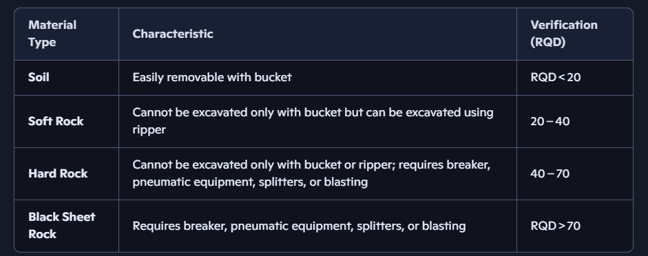
RQD (Rock Quality Designation) is a key indicator of rock hardness and excavation difficulty. Higher RQD values represent stronger, less fractured rock that demands heavier equipment or blasting.
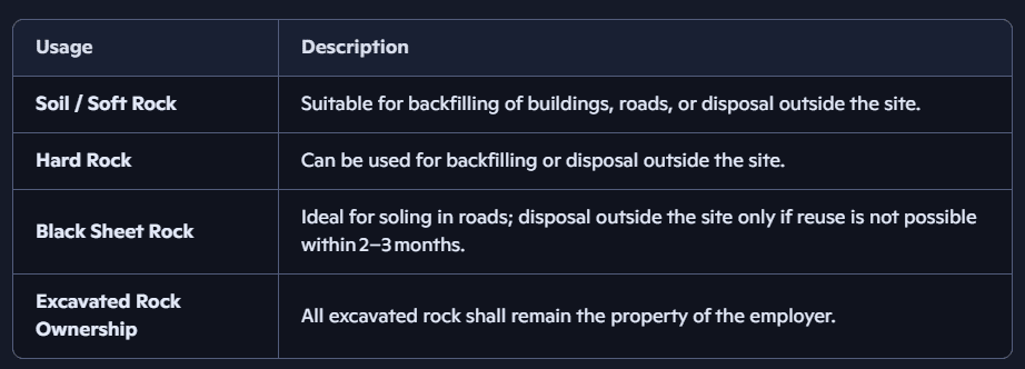
Usage Guidelines for Excavated Material
Rock Quality Designation (RQD) and Excavation Guidelines
In geotechnical engineering, understanding rock quality is crucial for safe excavation and structural stability. When the Standard Penetration Test (SPT) reaches refusal in hard strata, engineers perform rock coring using a diamond bit and double‑tube core barrel to collect rock samples.
From these samples, the Percent Rock Core Recovery and Rock Quality Designation.
Formula for RQD Calculation
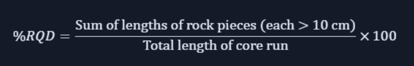
This formula helps quantify the degree of fracturing in rock strata — higher RQD values indicate stronger, more intact rock formations.
Proposed Excavation Measurement & Method
Excavation Pay Line
- Normal case: Outer face of the basement line
- Shore pile: Basement area + space between shore pile and basement line
Working Space Beyond Basement Line
- Retaining wall: 1500 mm from outer face of RCC
- Open foundation: 600 mm from outer face of RCC
- Post‑tensioning: 1500 mm from outer face of RCC
Grid Line for Levels
Standard grid: 2 m × 2 m
Side Slopes
Unless otherwise specified by the soil investigation consultant:
- Up to 3 m depth: 1 Vertical : 1 Horizontal
- Below 3 m depth: 1 Horizontal : 2 Vertical
- Hard rock: Vertical or up to 10‑degree slope
Joint Measurements in Earthwork
Accurate joint measures are essential for maintaining precision and accountability during excavation. As per standard practice, levels must be recorded systematically on each gridline to ensure consistency across the site.
Levels to Be Taken on Each Gridline
- Excavation pay line with level and side slopes
- Original ground level
- Soft rock top
- Hard rock top
- Excavation bottom level


[…] Nor you can read my Earth work Excavation related article. […]
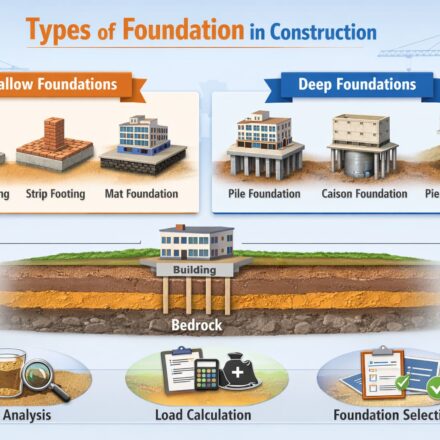
[…] From the simple strip footing under a village school to the 25-metre bored piles under a Mumbai tower, every type of foundation in construction carries the same fundamental responsibility keeping people safe in the buildings they occupy. Treat that responsibility with the seriousness it deserves, and the foundation will do its job silently and invisibly for generations. if you want to know more about excavation measurement click here. […]